Article
Find places of interest with Google Maps
- August 5, 2009
- Updated: July 2, 2025 at 9:21 AM
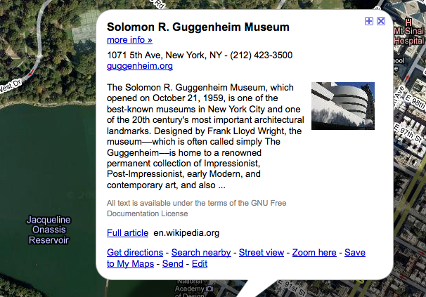
The one thing that I’ve missed on Google Maps has been the ability to see points and places of interest. Fortunately, the team have finally introduced this feature allowing you to get more out of the places you live-in and visit and even plan your holidays. Even better, you can click on a monument or building and get a popup window with more info a little bit like the way photos of points of interest can be added to Google Earth.
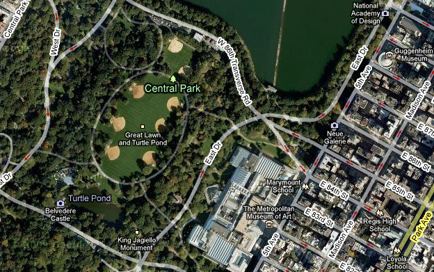
Now for example, you can plan a visit to New York’s never ending places of interest without even picking-up a guide book.
The popups also include handy business info, contact information and wikipedia entries.
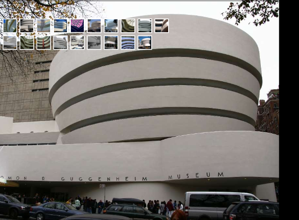
Using Street View combined with user photos, now you don’t even need to leave your computer to visit major landmarks using Google Maps.
The number of annotations around major cities can be a bit overwhelming however and so you can toggle the labels on and off using the floating check box that appears just under the “Terrain” button. However, it would be better if you could choose which labels you want to toggle on and off such as street names, points of interest, public transport points etc rather than just everything at once.

You may also like
 News
News1 in 3 Android apps have serious API leakage issues, according to a recent study
Read more
 News
NewsThe rise of fake captchas: a new weapon for cybercriminals
Read more
 News
NewsGoogle disables the 100 results per page feature and leaves users stunned
Read more
 News
NewsThe second season hasn't even premiered yet, and Disney+ has already renewed this superhero series for a third one
Read more
 News
NewsIs Hollow Knight: Silksong too difficult? Its creators defend that it is not
Read more
 News
NewsMicrosoft teams up with ASUS to launch ROG Xbox Ally and compete with Steam Deck
Read more